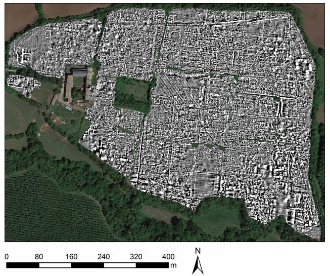
Unearthing ancient historical sites and learning about its complex details may take archaeologists several years when done the conventional way. However, an advanced technology known as ground-penetrating radar (GPR) eliminates the need to excavate these sites out in order to study them. Using the technique, researchers have mapped an entire ancient Roman City in Italy.
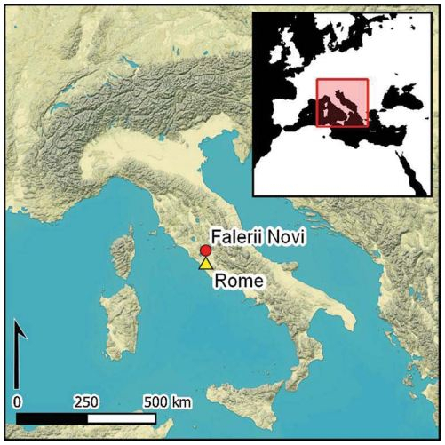
Falerii Novi, which is located 50 km from Rome, was 'unearthed' by a team of researchers from Ghent University and the University of Cambridge, using GPR. Several structures and features, including those that have been never been observed before, were identified. It was first occupied in 241 BC and is believed to have survived up to 700 AD.
"The astonishing level of detail which we have achieved at Falerii Novi, and the surprising features that GPR has revealed, suggest that this type of survey could transform the way archaeologists investigate urban sites, as total entities," said Martin Millett, the corresponding author of the study.
Mapping The City
Historical records of Falerii Novi have existed throughout time. Fortunately, the now underground city, is not buried under modern buildings. It has been studied using other non-invasive techniques such as magnetometry. However, GPR has enabled the gathering of a more accurate understanding of its landscape and design.
Falerii Novi is well documented in the historical record, is not covered by modern buildings and has been the subject of decades of analysis using other non-invasive techniques, such as magnetometry, but GPR has now revealed a far more complete picture.
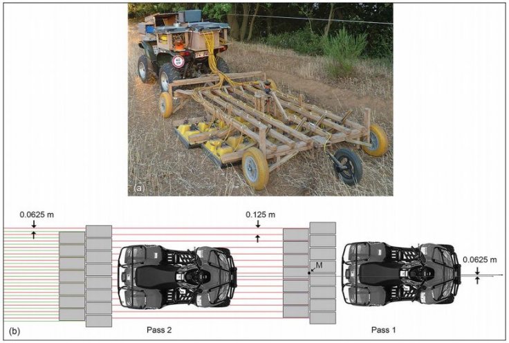
The function of GPR is similar to that of RADAR. Radio waves bounce off objects and the 'echo' produced is used to construct a picture at different depths. Attached to their quad bikes, the GPR equipment was towed by the archaeologists. The entire area of 30.5 hectares within the wall of the city was surveyed, and readings were recorded at every 12.5 cm.
Challenging City Planning Norms of The Era
Beginning with the physical changes that the city underwent during the course of existence, the new GPR data sheds light on several changes that the city underwent. According to the data, evidence of stone robbing are visible.
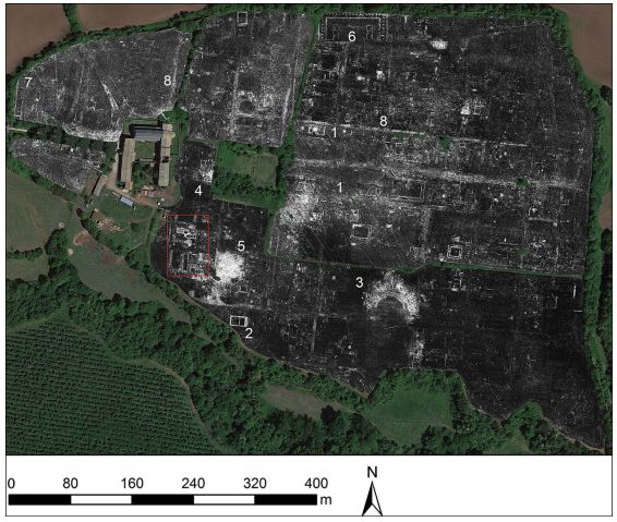
The notion that the urban design of Roman cities was standardized has also been challenged by the study. For example, in comparison to other well-researched cities and towns such as Pompeii, the layout of Falerii Novi was found to be less regimented. Structures such as the bath complex, temple and the market building that were unearthed were architecturally detailed. This is uncommon for a small city from the era.
Complex And Detailed Design
One of the findings that amazed the scientists was the pipeline system within Falerii Novi. In the southern district of the city, a massive rectangular building with a series of connected water pipes led to the aqueduct. Interestingly, these pipes can be found tracing across the city. Against the accepted norms of city designs of the times, the piped ran beneath the city blocks and not just along the streets. The authors believe that this large structure could have been an open-air, and a substantial part of the public bathing complex.
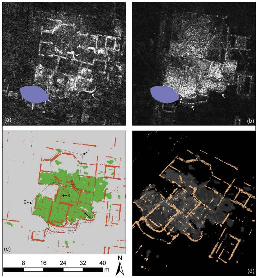
Another unexpected finding was that of two enormous structures facing one another, near the north gate of the city. They stood within a covered passageway with a central row of columns known as 'porticus duplex'. According to the archaeologists, no such parallels have been found in other well-studied cities. It is likely that these structures were part of an imposing public monument, and formed a sacred area at the edge of the city.
Potential of GPR Technology
Findings from the study can have substantial influence in the area of archeology. That is because the excavation of several ancient cities is nearly impossible due to their sheer size or because of them being buried under modern structures.
The GPR technology has already been employed by the team to map other ancient sites such as Interamna Lirenas in Italy, and Alborough in North Yorkshire on a smaller scale. They aspire to see its use on much larger sites.
"It is exciting and now realistic to imagine GPR being used to survey a major city such as Miletus in Turkey, Nicopolis in Greece or Cyrene in Libya. We still have so much to learn about Roman urban life and this technology should open up unprecedented opportunities for decades to come," expressed Millet.


