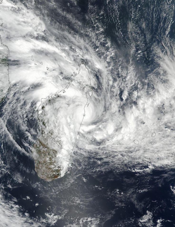
NASA-NOAA's Suomi NPP satellite passed over Tropical Cyclone Ava which has made landfall along the coast of northeastern Madagascar, moving west-northwest of Reunion Island.
As of Friday, Jan. 5 at 5:24 a.m. EST (1024 UTC) the Visible Infrared Imaging Radiometer Suite (VIIRS) instrument aboard NASA-NOAA's Suomi NPP satellite showed the eye of Ava over the northeastern coast near Mahavelona, as shown in the picture raising the bar of alerts.
Mahavelona town in the district of Toamasina II, in the region of Atsinanana is currently witnessing the eye of the tropical cyconic storm that is about 10 nautical miles wide as per the satellite image.
On Friday, Jan. 5 at 10 a.m. EST (1500 UTC) Ava had strengthened into a hurricane with maximum sustained winds of 90 knots (103 mph/166 kph), with the center of circulation located near 18.4 degrees south latitude and 49.2 degrees east longitude.
Located 361 nm west-northwest of St Denis, Reunion Island, Ava was seen moving west-southwestward at 6 knots (7 mph/11 kph), said NASA in a statement.
The Joint Typhoon Warning Center (JTWC) in its Ava forecast said the storm is tracked along the coastline of eastern Madagascar, reemerging over open water in a day. "Land interaction will weaken the system significantly to 65 knots (75 mph/120 kph), and with environmental conditions favorable this intensity should be maintained as Ava tracks southward over the Indian Ocean," said the forecast.
Earlier, NASA satellites showed a more well-formed storm and strong thunderstorms with heavy rainfall potential over central Madagascar, based on images of the Atmospheric Infrared Sounder or AIRS instrument that flies aboard NASA's Aqua satellite gathered temperature data on the storm using infrared light.
Infrared imagery on Thursday showed that cloud tops were as cold as minus 63 degrees Fahrenheit (minus 53 degrees Celsius), indicating heavy rainfall.
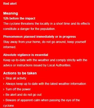
Météo Madagascar, the national weather agency has already issued red alerts and yellow alerts that cover a large area of the island's east coast.

Red alert issued:
Red alert usually issued 12 hours before the impact, forecasts that the cyclone approaching the locality posing a danger for the population.
The advisory says that people should not go around, and keep themselves informed about the weather and comply strictly with the advice or instructions issued by Local Authorities.
It has advised local people to turn off the power, not to venture out and be aware of the apparent calm when the eye of the cyclone is passing by.


