Global tech giant Google has released a series of Coronavirus Community Mobile Maps, by tapping location history data from users around the world to show how people are moving around local communities. The tech company made this unprecedented move to highlight how social distancing and shelter in place measures are changing people's behaviours.
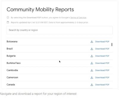
It should be noted that the initial release of these reports included 131 countries and each of these reports offer downloadable PDF files comparing recent location information with similar data from over two months ago.
These reports look at the mobility trends across six categories, such as- retail and recreation (cafes, museums, etc), grocery and pharmacy, parks (including public parks and national parks), transit stations, workplaces as well as residential. Each report is broken down by individual states or provinces, while US reports include individual PDF files for each specific state which gives a detailed insight.

Google location data
Senior Vice President of Maps Jen Fitzpatrick and Chief Health Officer of Google Health, Karen DeSalvo said in a blog post that the information is designed to help public health officials better understand the success of locally applied safety measures during the Coronavirus outbreak.
As per the blog post:
"This information could help officials understand changes in essential trips that can shape recommendations on business hours or inform delivery service offerings.
"Similarly, persistent visits to transportation hubs might indicate the need to add additional buses or trains in order to allow people who need to travel room to spread out for social distancing. Ultimately, understanding not only whether people are travelling, but also trends in destinations, can help officials design guidance to protect public health and essential needs of communities."
Acquired data from Google users
The tech giant mentioned that the data is anonymized to make sure no user data can identify a specific individual's movements. However, the data is only collected from those users who kept their location history settings on.
In the blog post, Google insisted that it's no breach of privacy. "To protect people's privacy, no personally identifiable information, like an individual's location, contacts or movement, is made available at any point," without giving details.
While the newly released data gives an insight into how significantly population movements have shifted in some regions over a very short period of time, there is no clear evidence that whether these reports offer required specificity to be of any real use to local public health officials.


Locked down countries
It should be mentioned that as per the Google data, the counties wherever the government has implemented stricter lockdown, significant behavioural changes were noticed.
As example in Italy, the data showed there is a 94 percent drop in retail and recreation behaviours, and an 87-percent drop in visits to transit stations, while in Sweden, which yet to declare a strong lockdown, a 24-percent drop in retail and recreation behaviours have been recorded along with a striking 43-percent rise in park visitations.
When searched by the IB Times SG in terms of India, where billions of people are asked to stay at home since March 22, as the government recently imposed the lockdown measures, the collected data by Google showed that there is a 77 percent decrease in retail and recreation, 65 percent downfall in mobility trends for places like grocery markets, food warehouses, farmers markets, drug stores and pharmacies and 57 percent fall in visiting places like parks.
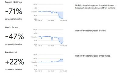
The report also showed that in terms of transit stations and mobility trends for workplaces, 71 and 47 percent drop have been noticed till March 29, while mobility trends for places of residence or at home increased to 22 percent.
However, as per Google, the data will be publicly available for a limited time, as long as public health officials find the data valuable.
See India trends below:


