The mysteries of our home planet have long baffled the humankind. While scientists and experts, over the years, have come up with answers to some, certain mysteries still keep them awake at night. The latest one to join the list appears to be the Earth ripples near the Markha River in Arctic Siberia. Scientists, across the globe, have no idea as to what might cause such a phenomenon.
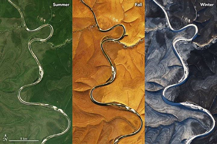
Recently, researchers at NASA shared a bunch of satellite images of the said location, which show some strange wrinkles on the landscape. The images were captured with the Landsat 8 satellite over years. The land on Markha River's both sides seemed to have rippling with dark and light alternating stripes.

The mystifying effect can be seen in all the pictures that Landsat 8 has taken over all the four seasons. Particularly, it appears the most prominent during winter, when white snow makes the contrast even more distinct in the aforementioned pattern.
Why Does this Particular Land has Those Strange Stripes?
Scientists are not sure about what it is or what might have caused it. Although multiple experts have come up with conflicting explanations, NASA is still dissatisfied.
Could it be the Ice?
As per NASA, most of the time of a year the Central Siberian Plateau region remains covered in permafrost, though it thaws for a brief period in intervals. So, the parts of a land, which continuously goes through the process of freezing, thawing and freezing again have been seen to have taken weird circular or stripe structures. This is known as patterned ground, scientists had reported in a 2003 study in the journal Science. It happens as the soils and stones of that particular land naturally sort themselves during the freeze-thaw cycle.
However, this kind of patterned grounds are usually much smaller in scale compared to the stripes observed in Siberia.
Or is it Erosion?
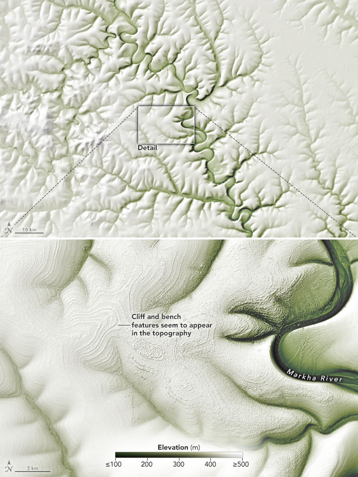
A geologist at the U.S. Geological Survey, Thomas Crafford informed NASA that the unusual stripes are not so unusual after all. They resemble layer cake geology, which is essentially a pattern in sedimentary rocks. This pattern is also referred to as "cliff and bench topography."
This phenomenon on lands takes place when snowmelt or rain trickles downhill. It fragments and flushes the pieces of sedimentary rock into piles. It is capable of revealing the sediment's slabs, which look like the slices of a layer cake, thus the name, said Crafford. Here the darker side represents steeper areas, whereas, the lighter side indicates flatter areas.
Also, this type of sedimentary layering would look more distinct during the, as the white snow settles on the flatter areas, which makes them look even lighter.

"It looks like small canyons, maybe like the Badlands of South Dakota. The horizontal striping appears to be different layers of sedimentary rock. The shape of the erosion pattern looks a bit different than standard sedimentary erosion, but my guess is that is due to the permafrost. The rivers are eroding through frozen ground. There could also be some effect from frost heaves affecting the topography," said Walt Meier, an ice specialist at the U.S. National Snow and Ice Data Center.
Now which is the perfect answer to this bizarre conundrum; only time and scientists might tell, following thorough observation and study of the region. For now, as mentioned before, they have no idea!


