Asia is experiencing a cold war scenario as two major Asian powers India and China are targeting similar space missions for 2018 and the upcoming years. The two countries are trying to gain an upper hand in space exploration and in using strategic earth observation satellite technologies which could change their stand in the world.
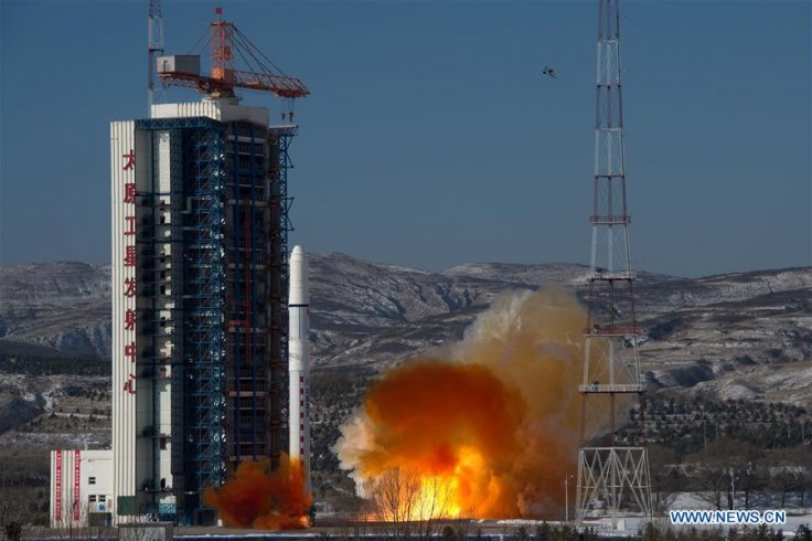
China has launched its SuperView-1 03/04 powerful remote sensing duo satellites on January 9, 2018, using their Long March 2D rocket. Meanwhile, India is all set to launch its high-resolution remote sensing satellite Cartosat-2D using PSLV launcher on January 12. Both missions use indigenously developed high-resolution remote sensing satellites for earth observation.
India's CartoSat-2F, the sixth satellite of the Cartosat2 series would provide strategic data for civil and military applications while China's SuperView-1 03/04 is said to aim for commercial use. The SuperView satellite would provide images of 0.5-meter resolution for commercial application. Chinese news agency Xinhua has reported that the remote sensing images from SuperView would be made useful for customers worldwide for land and resource surveys, mapping, environmental monitoring, finance, and insurance as well as for the Internet industry.
Indian Space Research Organisation's (ISRO) CartoSat-2F would provide high-resolution scene-specific spot imagery similar to the previously launched Cartosat satellite, Cartosat-2E, which could spot objects within a square of 0.6-meter by 0.6-meter radius.
Satellites in these series have various cartographic, urban and rural applications. They are used to monitor coastal land use, regulation and utility management. Other Cartosat functions like monitoring of road networks, water distribution, and creation of land use maps, identification of geographical and man-made features are also analyzed using the satellites.
SuperView-1 03/04 is the second commercial remote sensing satellite of China Aerospace Science and Technology Corporation. The earlier version satellite SuperView-1 01/02 had been launched in December 2016 as first mission Long March 2D rocket.
Both countries have plans to send their lunar mission this year. China aims to send its first human-carrying probe to the dark side of the moon in 2018. This mission has great significance as no other space agency has ever sent probes to the moon's mysterious darker side since the first lunar mission in September 1959.
India would also send its lunar mission Chandrayaan-2 during the first quarter of 2018. The mission would carry an orbiter, a lander, and a rover to study the surface of the Moon. The scientific payloads of the Chandrayaan-2 will collect information on lunar topography, mineralogy, elemental abundance, lunar exosphere and signatures of hydroxyl and water-ice. The Chandrayaan-2 mission offers great significance as its predecessor Chadrayaan-1 had been able to detect water in the surface of Moon for the first time.
China would also send the core module of its space station named as "Tianhe-1" in 2018 using Long March-5 heavyweight carrier rocket. The space station would be completed by 2020 using more components including two space labs. The mission aims to replace the International Space Station which would retire in 2024.
Even though India has abilities for a space station, the country might not start its development any sooner, instead focusing on developing other significant projects according to priorities. However, it might invest on a space station, based on future necessities. Several other missions have been planned by both agencies for the year 2018.
Indian and Chinese space agencies have significant positions among International Space Agencies as both countries have successfully undertaken Moon and Mars explorations. Also, both countries have independent Earth observation, communication and navigation satellites at their disposal.


