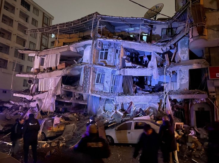
Turkey witnessed one of the strongest earthquakes in the last 20 years on Monday, with over 5,000 people killed and several thousand still trapped under the rubble. According to the United States Geological Survey (USGS), the 7.8 magnitude earthquake that struck early on Monday was one of the most devastating in recent times.
Two more quakes hit the region on the same day and they were equally strong. The first earthquake hit 11 minutes later and measured 6.7 magnitude on the Richter scale, while another in the evening measured 7.5 magnitude. Notably, this isn't the first time that Turkey has experienced such massive tremors. Turkey has a history of deadly earthquakes that killed more than 20,000 people all at once.
How Massive Was the Earthquake?

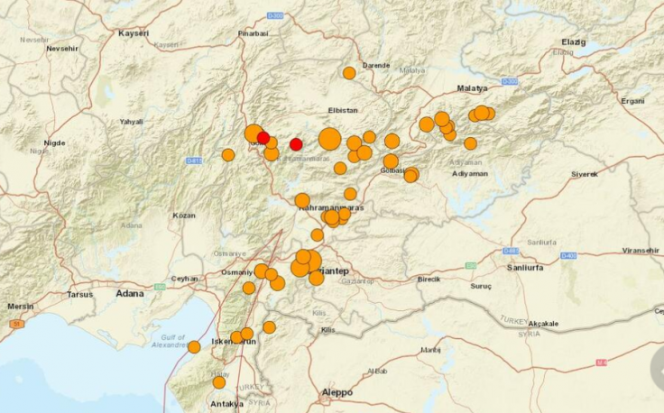
To put it in simple words, the tremors were massive and so was the devastation. The first earthquake, which had its epicenter close to the city of Gaziantep in south-central Turkey and has a population of more than two million, was first felt on Monday at around 4 am.
Numerous Syrian refugees who left their country's blazing civil conflict after 2011 are also included in this group. Turkish authorities reported that there were at least 40 aftershocks, some of which had a magnitude of as high as 6.7.
Nine hours later, the area was hit by two more earthquakes, this time with magnitudes of 7.6 and 6.0. According to authorities, at least 5,000 people have died in Turkey and Syria as a result of this earthquake, which is the largest to hit the area in more than 100 years.
How Extensive Was the Damage?
The U.S. Geological Survey estimates that the earthquake's focus was 18 kilometers deep. The epicenter was 33 kilometers from Gaziantep. According to the USGS, the region has many structures made of fragile concrete, which renders them sensitive to cracking, spalling, loss of strength, or steel corrosion. This makes them "extremely vulnerable to earthquake shaking."

According to Vice President Fuat Otkay, about 900 buildings were reportedly destroyed in the Turkish provinces of Kahramanmaras and Gaziantep. All structures on the cross-border corridor connecting the Turkish city of Diyarbakir to the Syrian cities of Aleppo and Hama collapsed as well. According to Raed Ahmed, director of Syria's National Earthquake Center, this was "historically, the biggest earthquake recorded in the history of the center."
What Is Turkey Earthquake Prone?
Turkey is frequently hit by earthquakes. According to the Disaster and Emergency Management Authority (AFAD), there were approximately 33,000 earthquakes in the region in just 2020. There were 332 earthquakes of a magnitude of 4.0 or higher among them.
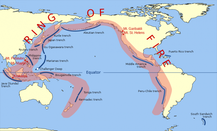
Turkey's tectonic location contributes to its earthquake susceptibility. About 15 large slabs, or tectonic plates, make up the Earth's topmost layer. A network of faults—fractures between two blocks of rock—defines the boundaries between these plates. According to the British Archaeological Survey, earthquakes can be brought on by any abrupt movement along these faults.

Turkey is located on the Anatolian tectonic plate, which is wedged between the Eurasian and African plates. The minor Arabian plate on the north side further restricts movement. The North Anatolian fault (NAF) line, which connects the tectonic plates of Anatolia and Eurasia, is one fault line that is recognized as being "particularly devastating."
The NAF, one of the best-understood fault systems in the world, extends from northeastern Turkey to the south of Istanbul and has been the source of devastating earthquakes in the past. It itself triggered two earthquakes in the provinces of Gölcük and Düzce in 1999, each measuring 7.4 and 7.0 in magnitude.

Over 45,000 people were hurt, and almost 18,000 people perished. A 7.1 magnitude earthquake that hit the eastern United States in 2011 once more claimed more than 500 lives.
Besides, there is the East Anatolian fault line, the tectonic boundary between the Anatolian Plate and the Arabian Plate, which is advancing northward. It extends 650 kilometers into the Mediterranean from eastern Turkey. Additionally, the Aegean Sea Plate, which is submerged beneath southern Greece and western Turkey in the eastern Mediterranean Sea, contributes to the region's seismic activity.

A third of the country, including the areas around the main cities of Istanbul and Izmir and the region of East Anatolia, is at high risk of earthquakes, according to one estimate, while about 95 percent of the country's land mass is thought to be earthquake-prone.
Why Are These Catastrophic?
There were 30,673 recorded earthquakes worldwide between 2013 and 2022. Only two of them surpassed the intensity of the earthquake on Monday. Only two of them surpassed the intensity of the earthquake on Monday.

Turkey was struck by a powerful earthquake of magnitude 8.0 in December 1939 that had occurred close to the eastern city of Erzincan. That devastating earthquake is reportedly the country's second-strongest tremor, according to reports. According to reports, approximately 1,20,000 buildings were damaged, and more than 20,000 people were killed.
After the extensive destruction, it experienced five more disasters between 1942 and 1967. But on August 17, 1999, a 7.4-magnitude earthquake that was close to the northeastern city of Izmit killed more than 18,000 people and left more than 2.5 million homeless. More than 130 people were killed in the country in another powerful earthquake in 2011.
Is Turkey Prepared?

Despite the irreparable damage, Turkey has not learned any lessons to prevent similar catastrophes in the future. According to media accounts, the structures date back a century and are constructed of subpar materials. Buildings constructed after the calamity in 1999 also don't meet earthquake safety regulations. Although the nation has strict legislation to address the most recent issues, other factors like poverty contribute to significant harm.


