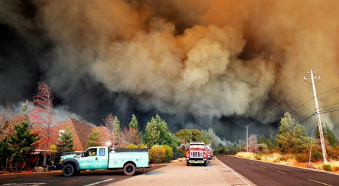
A newly released video provides a visual representation of the wildfires that ravaged different parts of the world throughout 2019. According to the creators of the video, it illustrates how bad the rate of wildfires has become this year.
The short clip was created by the European Center for Medium-Range Weather Forecasts as part of the Copernicus Atmosphere Monitoring Service (CAMS) program. It was made using the data collected by satellites for 12 months.
Wildfires All Over The World

The video mainly shows parts of the world burning, which represent the wildfire events that occurred throughout the year. These include the Kincade Fire in California, which destroyed about 80,000 acres of land. The wildfires in Indonesia, which produced more than 708 megatons of carbon dioxide, were also shown in the video. According to CAMS, the wildfires in Indonesia were the most intense incidents ever recorded in the region in almost 20 years.
Aside from these, huge parts of Australia were also burning in the video due to the recent bushfires that ravaged the country. According to reports, these bushfires became so massive that the smoke they generated reached parts of South America. Surprisingly, regions near the Arctic Circle were also affected by wildfires.
Worsening Rate Of Wildfire Activity
Mike Parrington, the senior scientist for CAMS said that the video clearly illustrates the worsening condition of wildfire activity in different parts of the world. Through the satellite data he and his colleagues have collected, they were able to observe how some areas displayed unusual wildfire activity in 2019.
"Throughout the year we have been closely watching the intensity of the fires and the smoke they emit all around the world and have experienced at times some quite exceptional fire activity," Parrington said in a statement. "Even in places where we would expect to see fires at certain points of the year some of the activity has been surprising."


